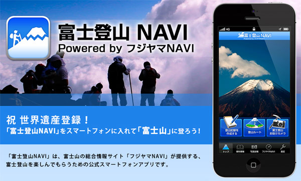
Climbing with the FujiYama Navi App
 Climbing Mt. Fuji? yep, there’s an app. for that c/w AR, photo diary, GPS, SNS uploads and friendly tips! http://bit.ly/14P8uJp
Machine Translation
By the GPS function, the required time, you can create a record of climbing Mount Fuji you just have to get the log moving distance, altitude, and total altitude.
In addition, it is also possible to see a real-time map on the climbing route. You can review it later as library data that you recorded, you can share Facebook, Twitter, by e-mail, etc. When you start the “Fuji climbing begging camera” in the climbing route of Mount Fuji, and displays them on camera as AR information with altitude information travel time and approximate the point made, such as branch points and lodge, and the next checkpoint. Such as the plan of rest and also maintain motivation, as Entertainment elements of little monotonous climbing, please take advantage of it to devise.
Photos posted to the “one piece of this week,” popular content comprehensive information site of Mount Fuji “Fujiyama NAVI” is easy. As long as it is captured only area around Mount Fuji, the events of the timing, subject animals and plants and natural phenomena does not matter. Photos of you may decorate the top of the page Fujiyama NAVI! (Yoshida, Subashiri, Gotemba, Fujinomiya route) and four major route of climbing Mount Fuji, I collect information Ohachimeguri of ascent after, of hiking trails around Mount Fuji to be able to enjoy more willingly. It is also available for offline application startup.
I record such as a URL and contact phone number of main transportation around Mount Fuji. This is useful in situations you can check the time of climbing bus, and hailing a taxi. Also, since I have links and hot water stop recommended, also, such as souvenir information after I climbed Mount Fuji, Please use!